Different Systems For Your Collection Needs
CS9400-OR Accelerometer Only
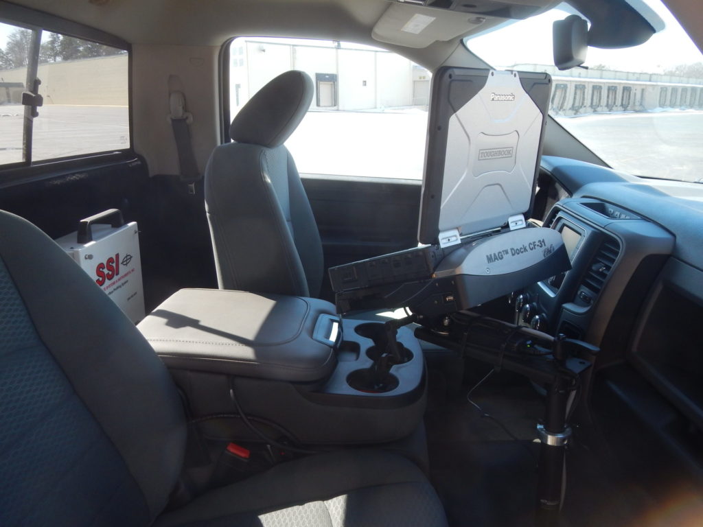
The CS9500 or Accelerometer-only system has been used for years on tracks where laser sensors are impractical or unsafe. For tracks that have too much elevation change or can damage equipment with brush or bottlenecks. The accelerometers, computer, and electronics are all safe inside the cab. The only piece of equipment outside of the truck is a GPS antenna on top of the cab.
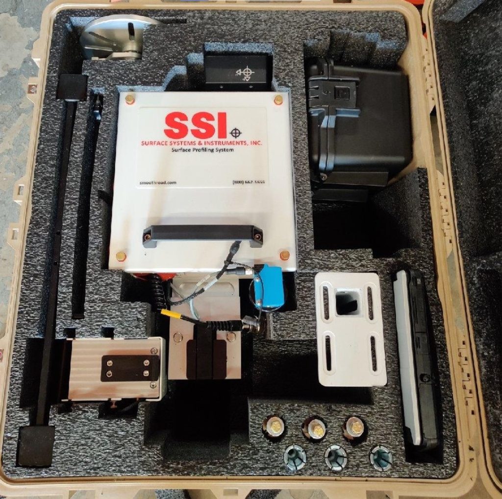
CS9470 Grade Profiler
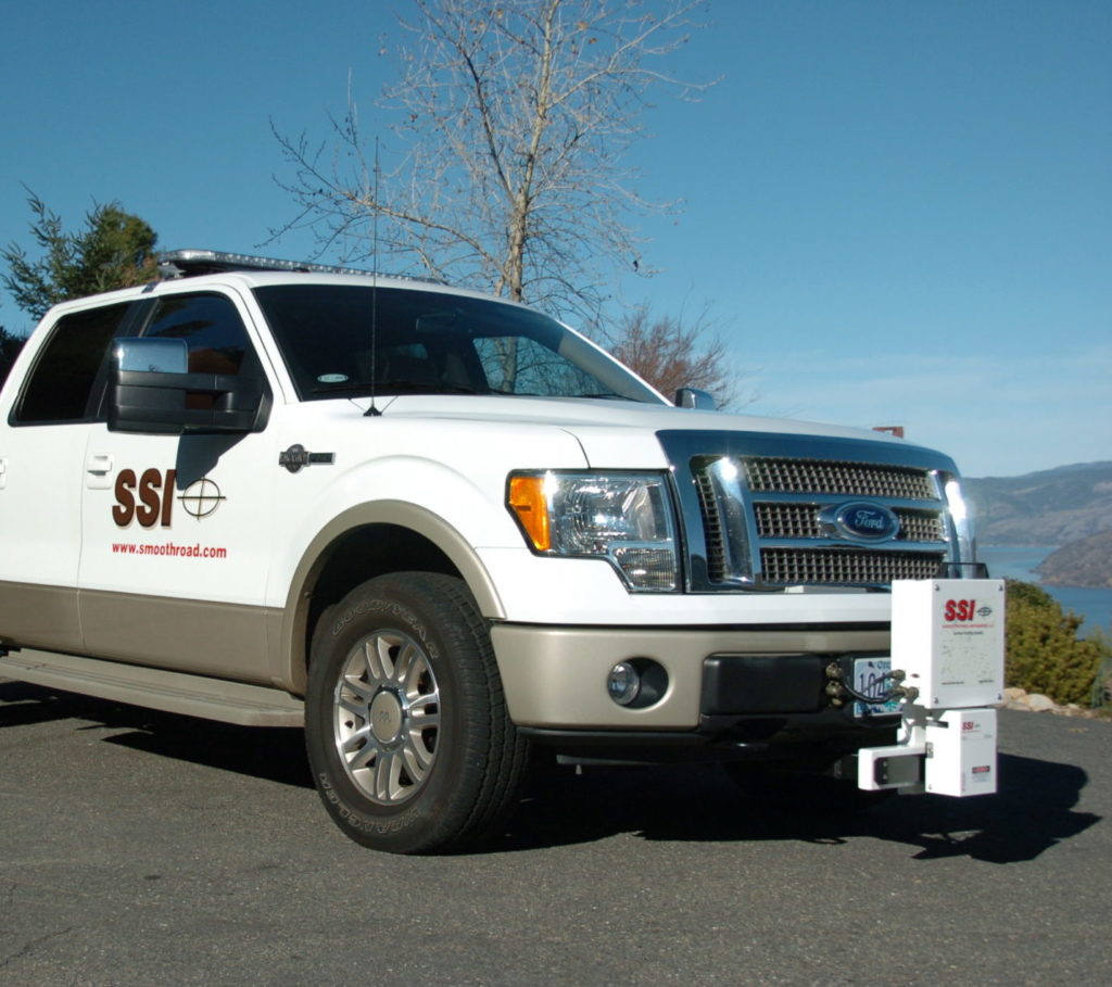
The CS9470 Grade Profiler uses a combination of an inertial profiler along with an INS-PPK system to capture accurate changes in elevation. The CS9470 can be configured as single or dual wheelpath hardware based on the CS9400 single laser hardware. The system is either mounted to truck tow hooks or on a 2-inch hitch receiver.
The sensor can be a laser for more accuracy or a sonic sensor for durability on tracks with dust, moisture, and debris.
The INS-PPK is used to accurately detect the grade changes. The PPK horizontal position is accurate to 10mm while the elevation is accurate to 25mm. The collection system uses the profiler’s sampling interval to index the changes in grade or cross-slope detected by the INS unit.
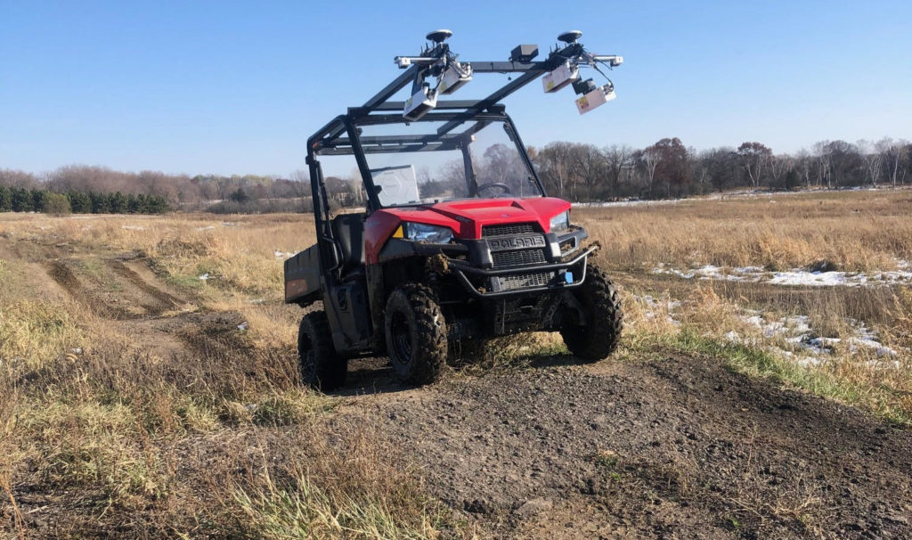
CS8770 Survey Profiler
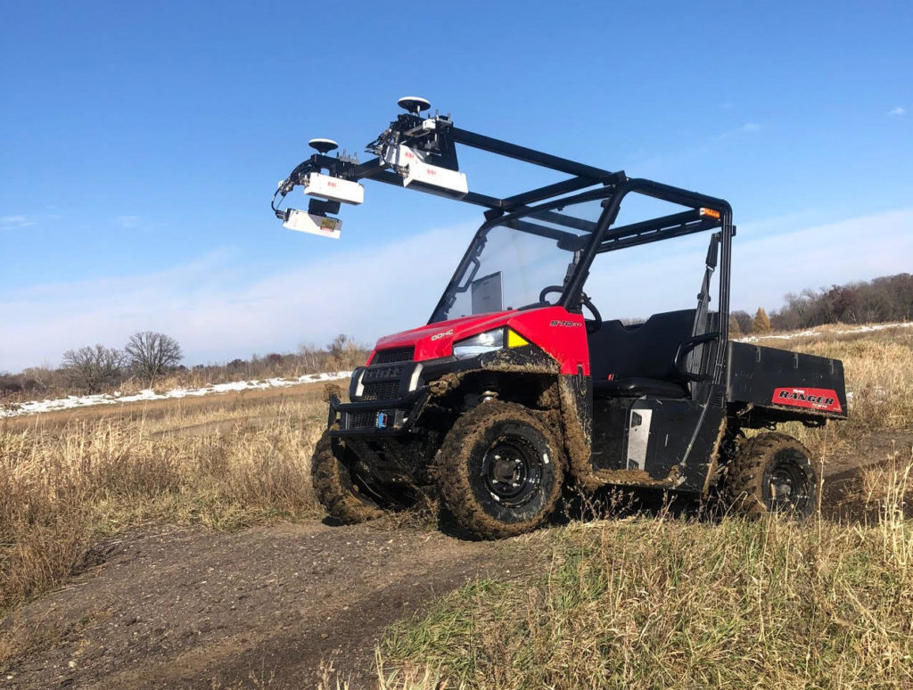
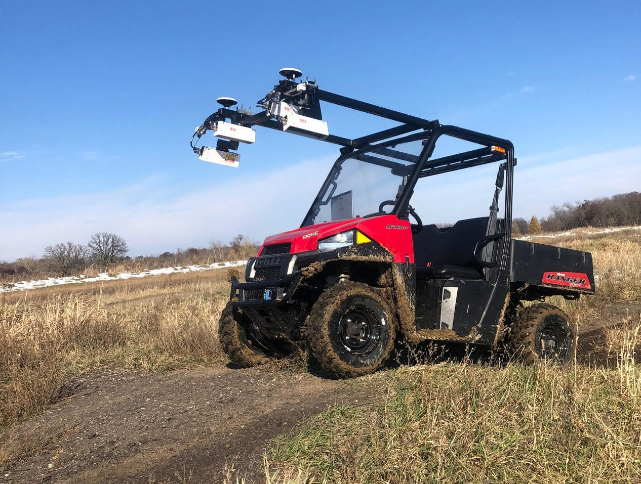
The CS8770 has a Polaris Ranger vehicle platform with four high standoff lasers to collect ~9-foot transverse width (2.7 meters). The collection software and processing is identical to the CS9500 Full Lane Survey Profiler.
The CS8770 would be used in situations with rugged terrain and in locations where a truck would not fit (like a bike path).
Select your own fixed sampling interval for transverse and longitudinal. The points are not collected by time so you will not have variable point spacing or issues with slow speeds.
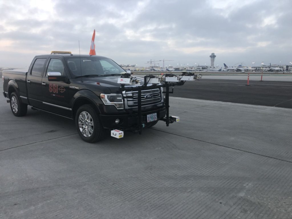
CS9500 Survey Profiler
The CS9500 Full Lane Survey Profiler can be used offroad. The hardware would be mounted to have clearance over any obstructions. All other collection procedures would match the CS9500 platform. The collection width with six lasers is up to 14-feet (4.3 meters)
Select your own fixed sampling interval for transverse and longitudinal. The points are not collected by time so you will not have variable point spacing or issues with slow speeds.
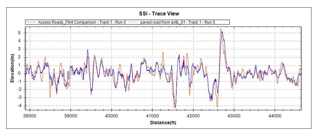
Survey Accuracy For True Elevations or Relative Profile Devices
Same System With Versatility
The SSI collection platform allows collection of survey accuracy with the CS9470 Grade Profiler, and CS8770 or CS9500 Survey Profilers. These survey elevation units can also collect relative elevation profiles like the CS9400-OR and an inertial profiler.
The sensors can be interchanged depending on the collection type and environment.
For wide scan point clouds the the CS8770 or CS9500 are used. These point clouds are typically near a million points per mile at highway speeds (55mph/88kph)
Hardware
- CS9400-OR hardware is easily mounted to vehicle interior
- CS9470 has the ability to mount to 2″ hitch receiver or tow hooks
- CS8770 mounting frame is fixed to Polaris Ranger
- All systems use SSI electronics housings and IP67 connectors
GPS Receivers
Multiple GPS receivers are available from SSI. For off road systems, the GPS is embedded with the INS system for added satellite constellations, reception reliability and accuracy.
-
- Embedded GPS, Glonass, Beidou, Galileo constellations optional
- Over 35 satellites available
- Up to 100Hz Sampling
- Non-Corrected GPS position accuracy: 0.75 meters
- Satellite (non-base station correction) accuracy: 4 cm
- PPK Horizontal Accuracy: 1 cm
- PPK Vertical Accuracy: 2.5cm
- IMU Pitch and Roll Accuracy: 0.02 degrees
- IMU Heading Accuracy: 0.1 degree
- IMU Velocity Accuracy: 0.02 m/sec HRMS
- Satellite Signals: L1/L2
- Cold Start, Time to First Fix: <60 seconds
- Dynamic Range (Gyro, Accelerometer): 125˚/s, 8g
- Bias Instability (Gyro, Accelerometer): 0.8˚/h, 3.2µg
- Embedded GPS, Glonass, Beidou, Galileo constellations optional
SSI Profiler Software
- Reports IRI, MRI, HRI, PRI, RN, and Localized Roughness (with adjustable bump and dip templates)
- PPK corrections for Kvalue curve reporting
- Instant test results and viewing of profile traces and reports
- Outputs longitudinal profile, elevation data, slope, simulated profilograph, raw strip trace, ERD/PPF (for ProVal), and PRO formats
- Multiple trace reporting allows cross-surface analysis of parallel profile traces (patented by SSI)
- Append data to existing files for comparison of original surface condition with corrected surface
- Profile reports and traces available on-screen, in PDF images, Excel (templates supplied), hard copy print out, or electronic formats
- Colorized traces and highlights of bonus/penalty profile areas
- Encrypted raw data for infinite reanalysis with variable parameters
- Data infinitely rewritable with variable analysis parameters (English or Metric units, profile indexes, data filters, localized roughness).
- Troubleshooting
- Embedded PDF user manual in software
- Send Feedback or report issues to SSI staff directly
- Real time diagnostics monitor system health and ease support
- Desktop license supplied for viewing, analyzing, and printing data
- Software updates by self-executing internet download
- On-site customer training and support worldwide
Available Features
- Export to curve K-value or extract elevation lines
- Report IRI (laser systems are DOT certifiable inertial profilers)
- GPS-DMI or INS-DMI
- INS-PPK corrections within SSI Profiler
- Medium or high resolution GPS receivers with multiple constellations
- SSI receivers can detect more than 35 satellites
Standard Features
- GPS Receiver (1.5 meter accuracy)
- Sub-meter accuracy available and PPK corrections
- Collect, Edit, Analyze, View, and Report Data in SSI Profiler
- Excel, PDF, Text, PPF, ERD, PRO exports
- Program updates when connected to internet

