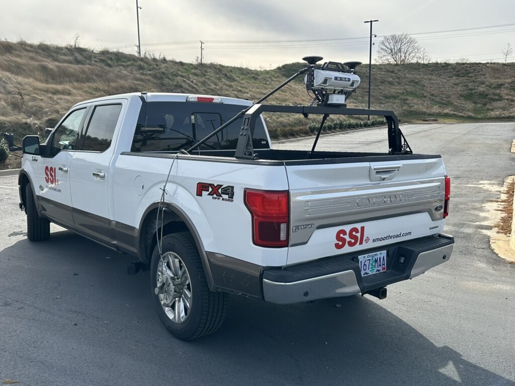
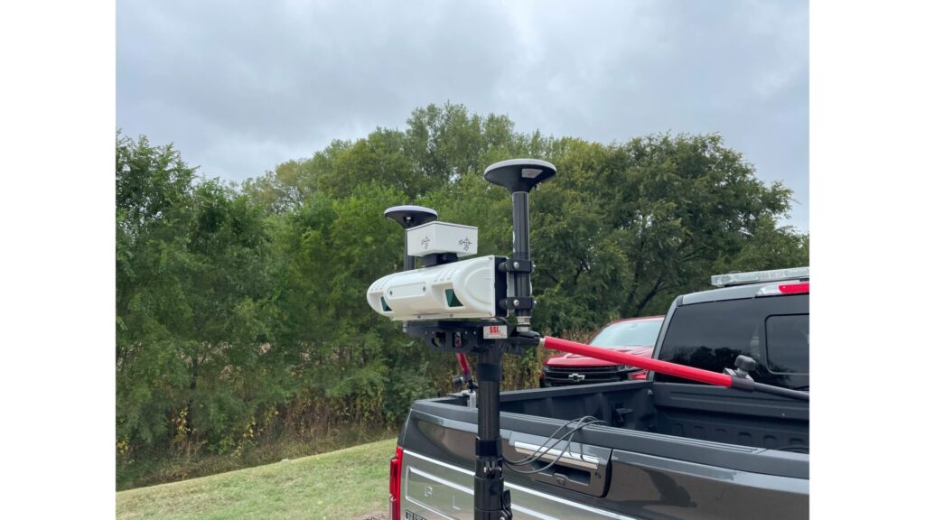
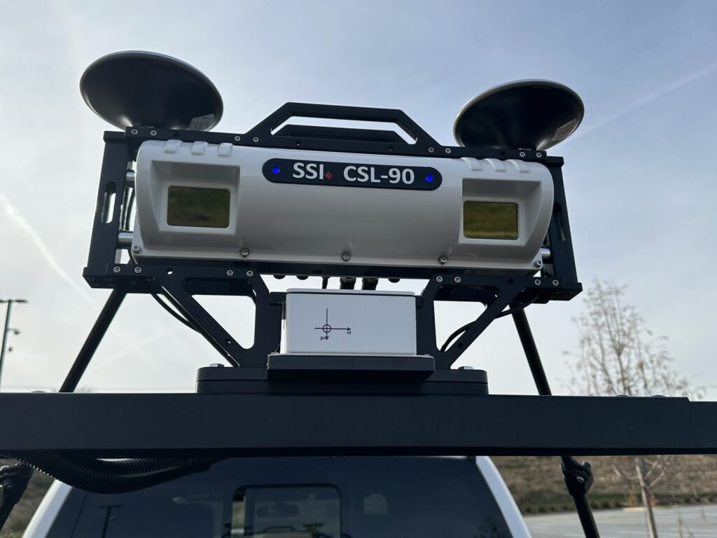
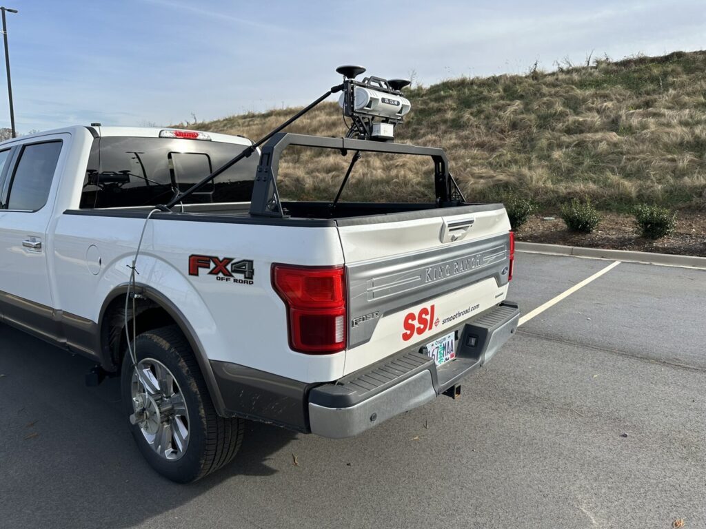
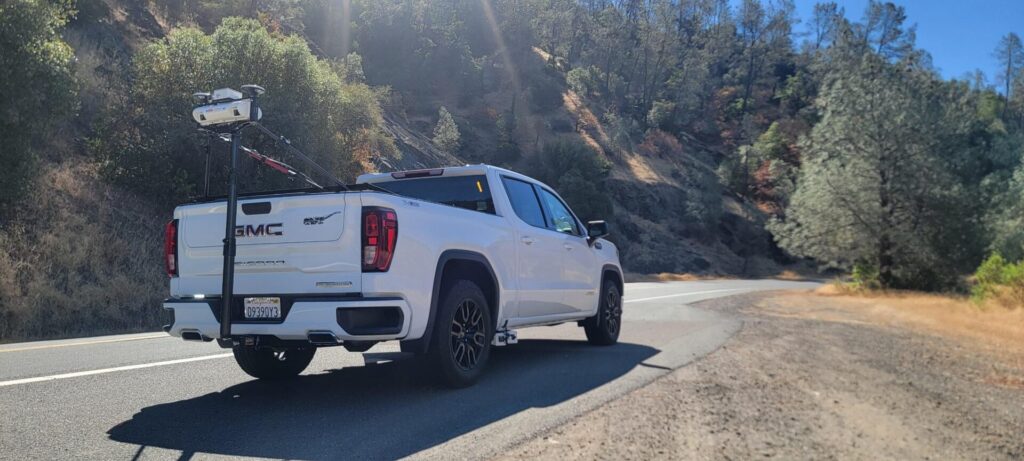
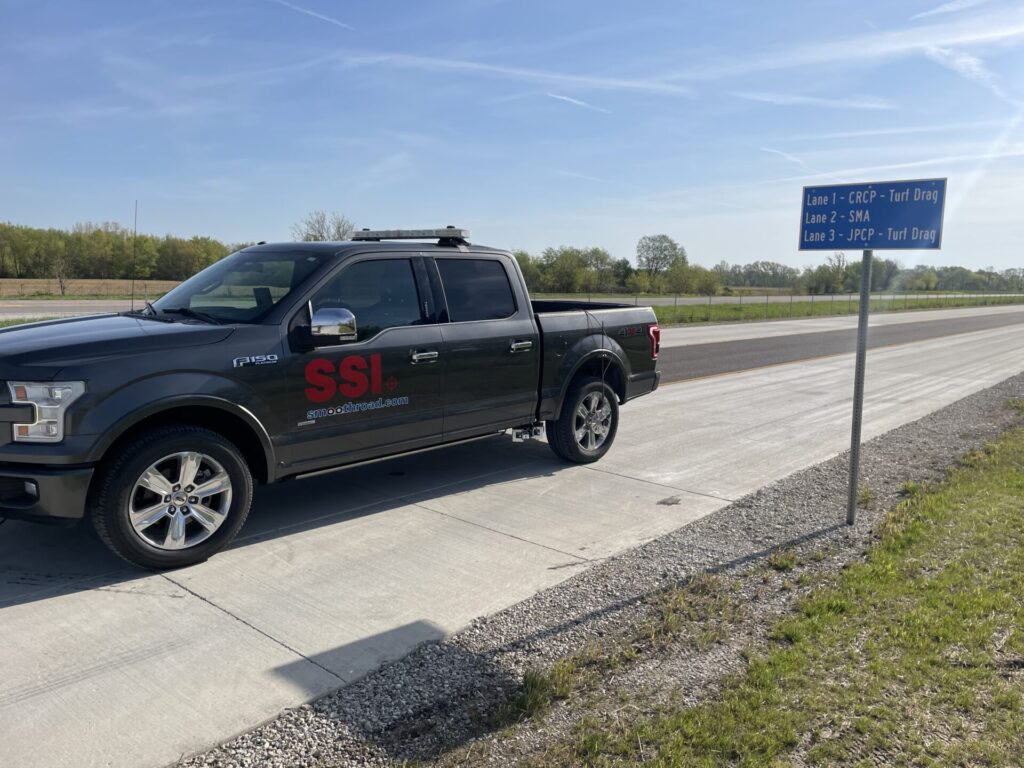
CSL-90 Portable LiDAR Survey Profiler
Full Lane Width Scans with a Solid-State LiDAR System, Including AASHTO Compliant IRI Measurement
At A Glance
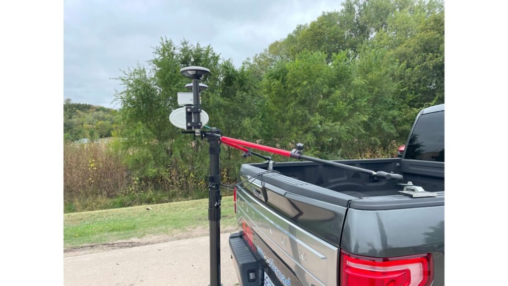
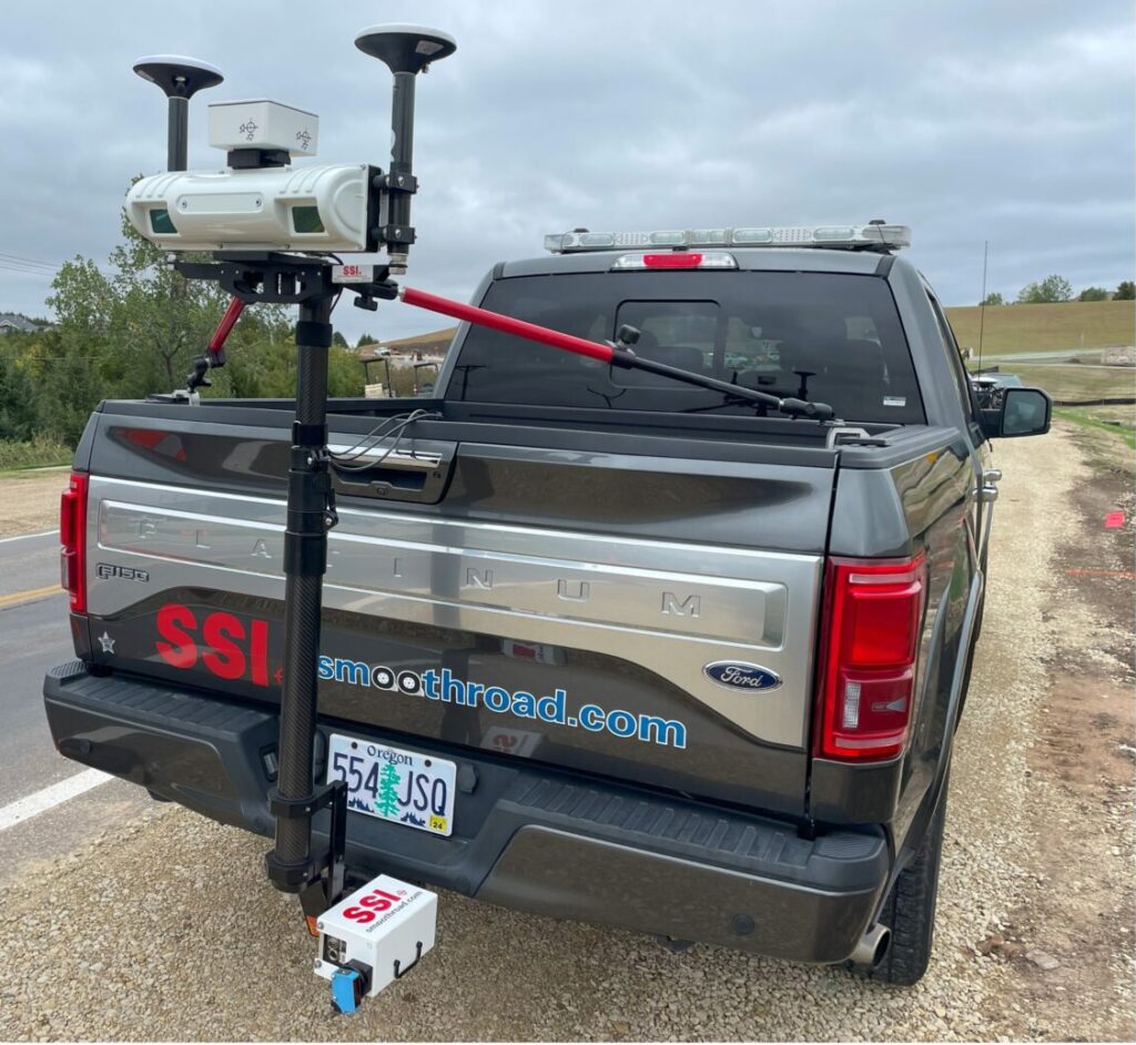
The CSL-90 can be paired with any of the SSI software or sensors including: ROW cameras, inertial profiler sensors, and macrotexture measurement. The LiDAR sensor can report IRI profiles accurate enough to pass the AASHTO certifications, but sensors can be added for full compliance. At highway speeds near 50 mph the LiDAR sensor can collect less than a 1-inch x 1-inch grid (25mm x 25mm).
Highlights of the CSL-90:
- Collect Survey Data in One Pass per Lane
- 4-meter wide (13.1-foot) Scan Width with Solid State LiDAR sensor
- 0.45mm Accuracy on 28,000 LiDAR Beams
- Report IRI from LiDAR Point Cloud or Inertial Profiler Sensors
- AASHTO and ASTM Compliant Inertial Profiler
- Tight Sampling Interval at Highway Speeds
- Zero-Speed Inertial Profiler Capable
- Portable Setup, Factory Calibrated
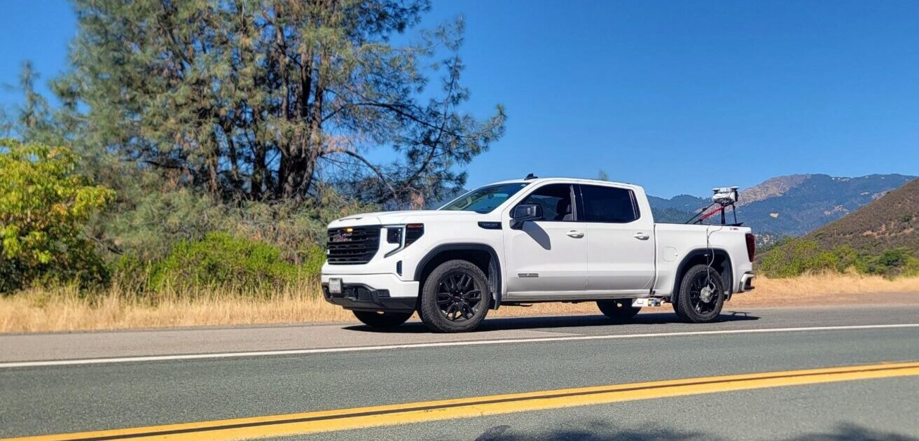
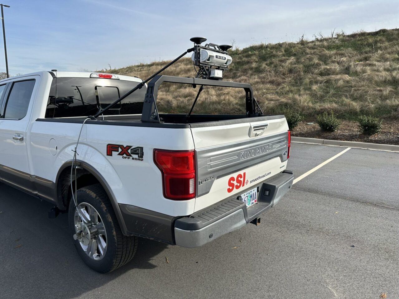
The CSL-90 Portable LiDAR Survey Profiler is an adaptation of the CS9500 family of survey profilers. With improved sensor capabilities, the CSL-90 captures the full lane width with a single LiDAR sensor. All of the features of a full lane scanner remain within the CSL-90’s smaller footprint.
The CSL-90 can include a single, dual or three track high-speed inertial profiling system for AASHTO and FAA compliant smoothness testing. This platform can also be upgraded to a Zero-Speed Inertial Profiler. As a single track profiler unit, the CSL-90 is ideal for airfield survey and smoothness testing. The CSL-90 can report an IRI or PRI value through the SSI software.
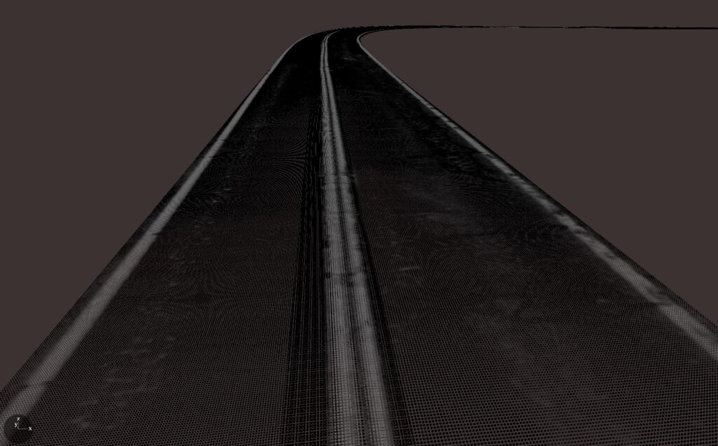
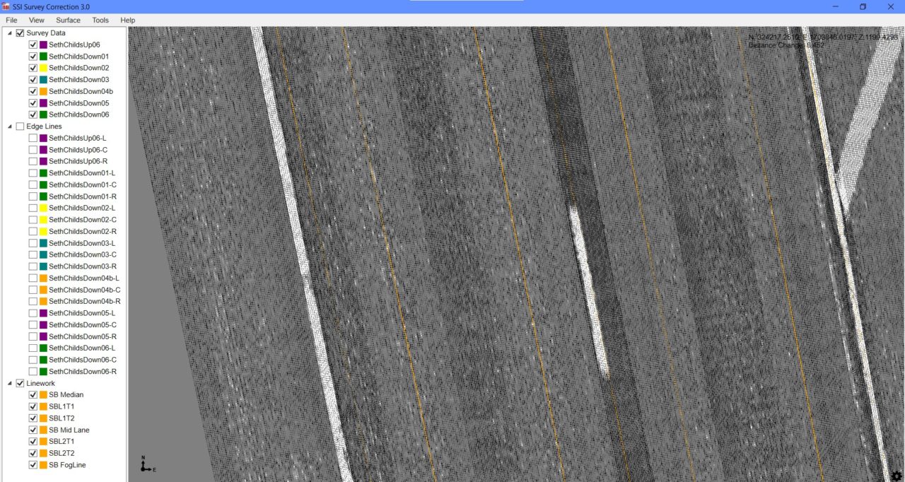
Once overlapping scan data is collected, a 2D or 3D point cloud surface can be created within SSI software. This point cloud can be exported into SSI’s Profile Design or another design software.
The CSL-90 hardware and software core features:
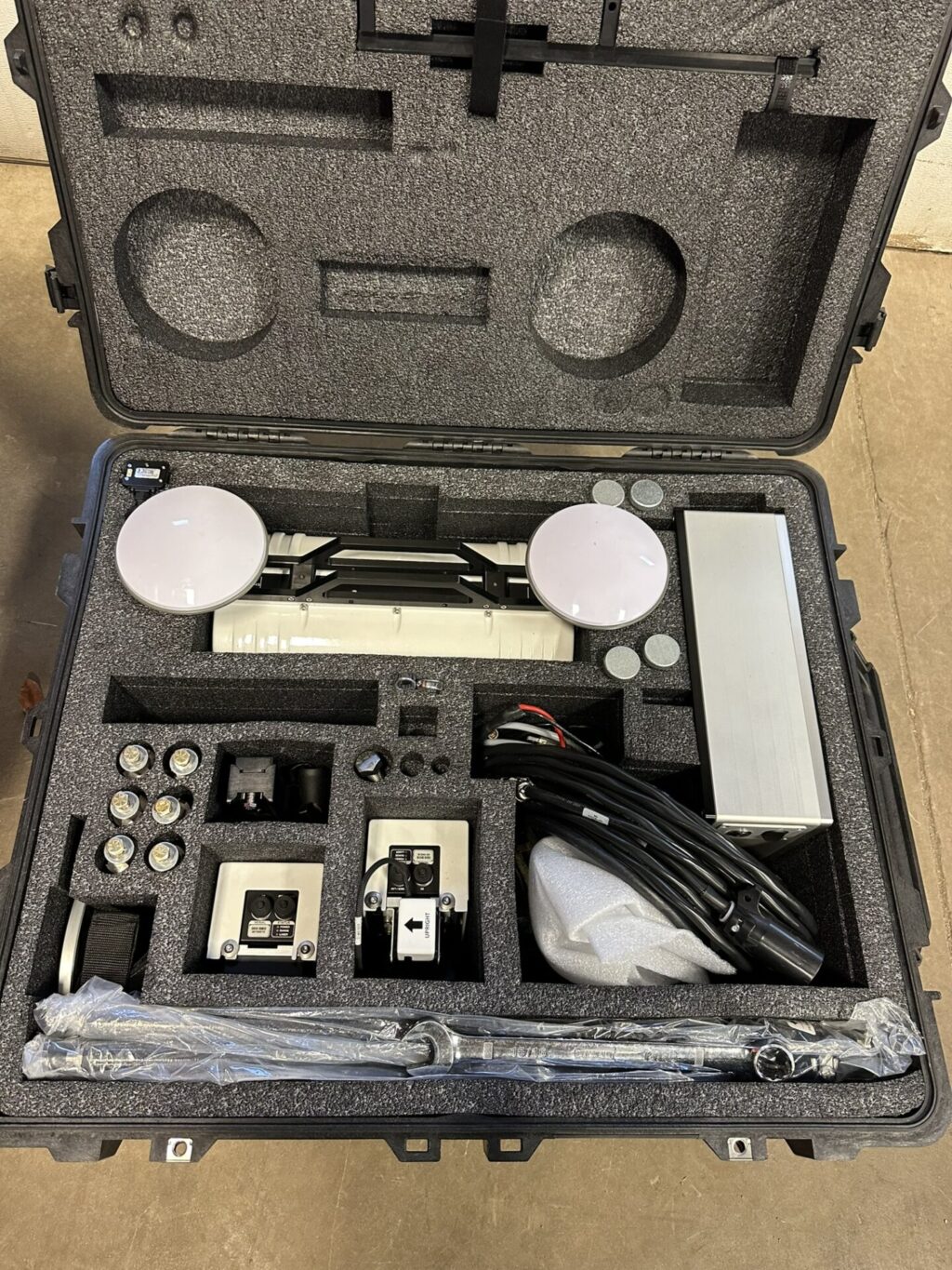
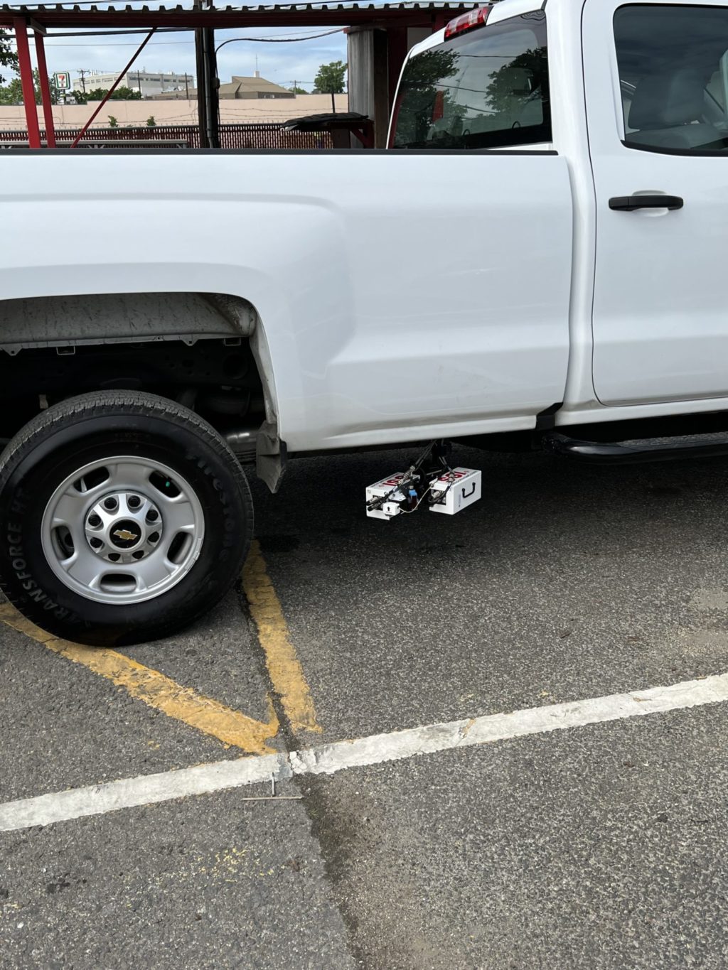
- Portable setup, mounts to hitch receiver. Ships and stores in a custom foam case.
- Single, dual, or three track inertial profiler (AASHTO R56-57, ASTM E950) integrated within system and simultaneously collects profile data
- 4-meter (13.1-foot) wide scans
- Collect data at highway speeds
- SSI CAD program to merge control points into dataset for secondary correction
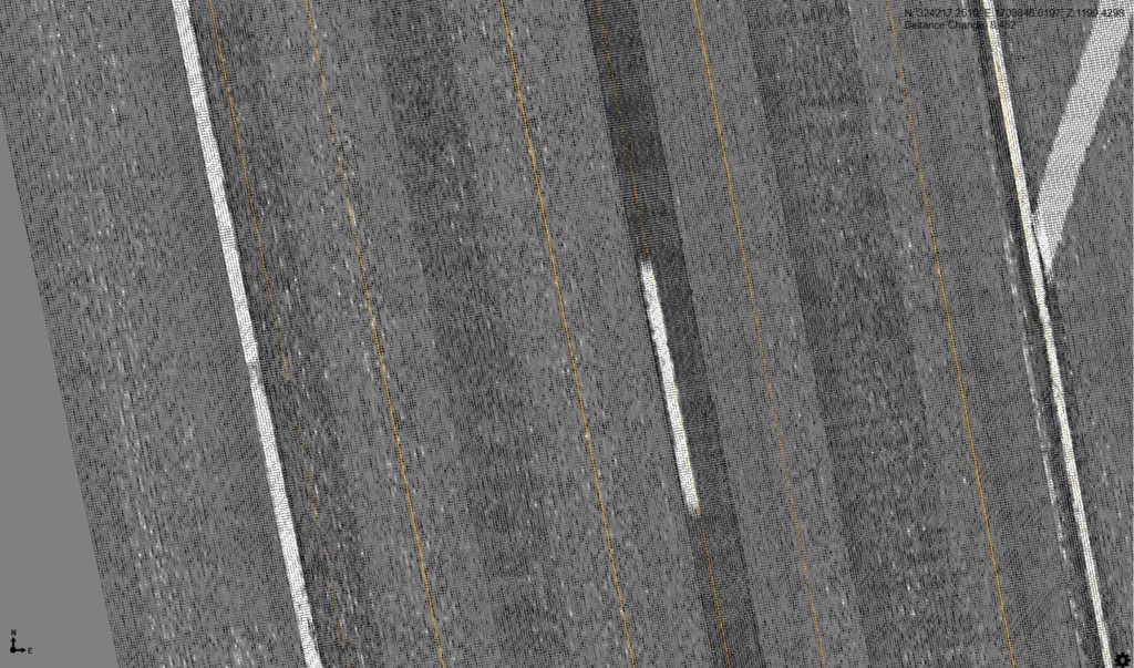
- Intensity displays lane lines and delineation
- Scalable: Start with CSL-90 for LiDAR point clouds and upgrade an integrated inertial profiler at any time.
- SSI software merges elevation correction points for precise 3D elevations
- Outputs data in common formats (e.g.) PNEZD, PLLHD, GPGGA, and LAS
All-In-One Design
The CSL-90 LiDAR Survey system can report IRI from the LiDAR unit or by using an integrated inertial profiler. The CSL-90 reports IRI, PRI, HRI, RMS, RN (longitudinal profile), transverse profile, and 2D/3D surface scans for land surveying and machine control applications.
2D+ or 3D Capable Models
The CSL-90 system can also be used for 2D scanning for pavement rehabilitation work that does not involve paving to 3D elevations. This is typically known as differential milling or paving.
SSI’s software includes a Profile Design module for configuring slope and cut/fill parameters for a design output optimized for best IRI results. The resulting model can be imported to machine control systems, including 2D or 3D grade control systems.
Software
The CSL-90 software attributes include the following:
- Ride quality (IRI, PRI, RN)
- Cross-slope reporting
- Data compatible with ProVal
- User configurable data collection and analysis parameters
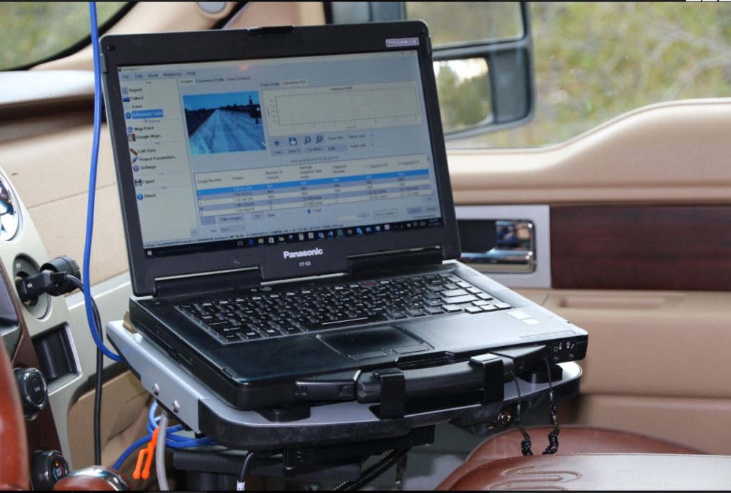
- Easy software for calibration, collection and analysis of data on in-vehicle Toughbook; software license for use on desktop PCs.
- Patent-Pending process combines inertial profiler data with IMU and corrected GPS/Control for 2D/3D surfaces.
- Dense surface data for better designs.
- Create a design file with 2D or 3D survey data in conventional survey formats, but with higher resolution.
- Use surface data in SSI Profile Design module to analyze existing surface and optimize design for best smoothness values.
- Configurable design parameters for slope, cut/fill and smoothness.
- Data compatible with third-party CAD design software.
- Design flexibility—resurvey surface to assess changes as project build progresses. Build based on the true surface profile.
- Surface designs work with both milling and paving machines.
- Separate or combined data formats: profile only, slope only, GPS only, or integrated 2D/3D survey data.
- Multiple export formats: PNEZD, PLLHD, LAS, Excel, CSV, ERD/PPF, Custom TXT & PDF.
- Precisely calculate areas of localized roughness for corrections or bonus/penalty results.
- On-screen GPS navigation along profile data.
- Surface data complies with DOT & Industry specifications.
- Web based issue reporting and automatic software updating.
Hardware
The CSL-90 hardware attributes include the following:
- Single, dual, or three track inertial profiler for IRI or PRI smoothness testing (compliant with AASHTO M328, R054, R056-057 ASTM E-950, and state/provincial agency specifications).
- Limited calibrations required – all sensors are fixed on the CSL-90 frame
- Scalable: Start with LiDAR scanner and add inertial profiler sensors later
- Testing at highway speeds. Less than 1-inch grid at 50 mph (25mm at 80 kph).
- Multiple configurations available; examples:
- 2 laser wheel track profiles, IMU and GPS for 2D relative inertial profile.
- Multi-laser full lane width profile, IMU and corrected GPS/control data for highest resolution 3D Topo.
- Macrotexture measurements per ASTM E1845
- Detachable core components minimizes risk of damage or theft.
- Panasonic Toughbook rugged operator interface computer with solid state hard drive
Correction Point Merger
SSI survey scanners collect data as a 2D scanning system that is PPK corrected. Individual lane scans can be merged together and with control points to improve vertical elevation accuracy. The SSI CS9500 scanners can achieve 6mm vertical accuracy on 95% of the point cloud.
Cross Slope Accuracy
The cross-slope reporting with the CSL-90 is accurate and repeatable. The INS and solid state LiDAR work together to cancel vehicle motion and measure the cross-slope across the entire lane instantaneously, like a cross-section snapshot. The transverse profile has a sampling interval less than 1-inch (25mm) laterally across the road.
Profile Design
Use SSI’s Profile Design to create variable cut depth models based on smoothness profiles or cross-slope requirements. The collected surface is used to extract longitudinal lines within the wheelpaths or lane edges. These lines are imported into the Profile Design program. Operators can smooth the extracted profiles and determine the cut depth at every inch along the project. Cut depth thresholds are displayed for simple interpretation and manipulation. More IRI analysis features than other software to identify hot spots or problem areas.
Intellicut Corretive Grinding
Intellicut is SSI’s version of dynamic diamond grinder simulation. The corrective grind locations determined by Intellicut are based on the wheelbase and dynamics of the diamond grinder.
Improving on other commercially available options, Intellicut:
- Is automated. Set your grinder model and IRI threshold. The program will determine the grind locations and iterate until no grinds are left or the IRI threshold is achieved.
- Set short continuous ALR, long continuous, or fixed interval. Intellicut will grind until one or all three are in compliance.
- No need to open a 3rd party program. Intellicut is built into SSI Profiler
- The grind locations are saved in the raw data file for others to view.
- Export the final grind plan to PDF